
K-TRAVEL · July 2026
Google Maps in Korea: The 19-Year Wait Is Almost Over
What to Install Before You Land
A Level 6 Local Guide tests all three Korean map apps on one route, on one lunch break.
When I wrote about getting a Korea travel SIM card from $4, I said data is the first thing to sort out at the airport. This is the second thing, and it matters just as much: which map app will actually get you to your hotel. In Korea, the answer is not the one already on your phone.
As of this writing in July 2026, Google Maps in Korea still cannot give you driving or walking directions, even though the Korean government finally approved Google’s map data export in February 2026 after a 19-year standoff. So on my lunch break, I tested Google Maps, Naver Map, and KakaoMap on the exact same route to Seoul Station. Here is what you should install before you land, and why.
Why Google Maps Is Half an App in Korea
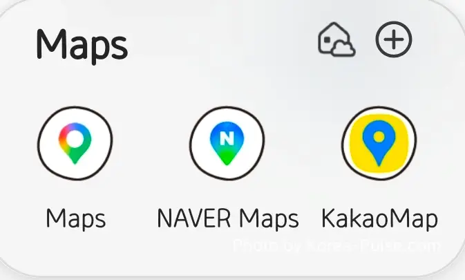
First, a word on why this post compares Google Maps against two apps you may never have heard of. In most of the world, Google Maps is the default and the conversation ends there. Korea is the exception. Here, the search engine everyone actually uses is Naver, the country’s homegrown Google, and its Naver Map is the navigation app locals live by. The other is KakaoMap, made by Kakao, the company behind KakaoTalk, the messenger on nearly every phone in the country. These are not niche alternatives. They are what 50 million Koreans open first, and by the end of this post you will understand why a local reaches for them over Google.
Now let me get my bias on the table. I am not a Google Maps skeptic. I am a Level 6 Google Local Guide with reviews scattered across the 40-plus countries my construction career has taken me to. Back when my family lived in the UK, I even blogged a data-usage shootout between Google Maps and Waze on a London round trip, and I remember typing one wistful line: I wish Korea worked this way too.
It didn’t, because of a very Korean piece of history. Since 2007, the government refused to let Google export the 1:5,000 base map data that turn-by-turn navigation needs, citing national security. Google asked again in 2016 and was refused again. Then, on February 27, 2026, after a fourth application and three deferrals, the government’s map export council finally said yes, with strict conditions: sensitive data processed on domestic servers, military sites blurred, contour lines excluded, and even an emergency “red button” Google must build. The official announcement reads like a treaty. Nineteen years, start to finish. And the security work it demands is, in short, why Google Maps still does not have driving navigation in Korea today.
Here is the catch for you, the traveler of July 2026: approval is not implementation. The government verifies every condition before any data leaves the country, and Google has said it is still working out how to build the service. Some industry observers expect at least six months of processing after approval. I check the news weekly (yes, really), and if you force a guess out of me, pure speculation, I would say around September. The moment Google Maps navigation goes live in Korea, I will update this post. Until then, read on.
The Test: One Lunch Break, Three Apps, One Destination
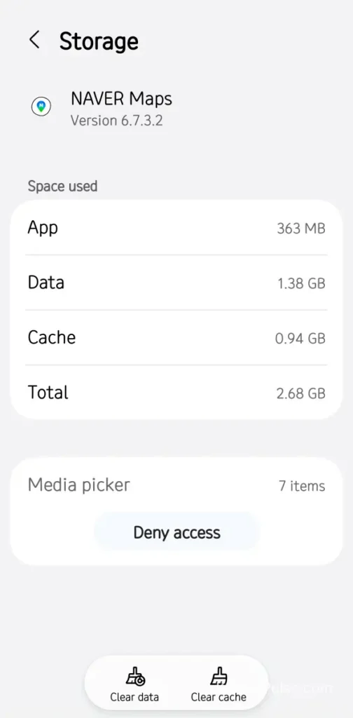
My office sits near Euljiro (을지로), a downtown district whose underground arcade I walk every day. So the test route was obvious: from the Euljiro 3-ga underground arcade to Seoul Station, a classic tourist leg. To keep things fair, I wiped Naver Map and KakaoMap back to factory state, cleared data and cache, exactly the blank slate you would have after installing them at the airport. Google Maps stayed as-is, because most travelers already have it installed.
One honest disclosure before the results: Naver Map is my daily driver. I commute by subway every working day, I drive on weekends, and I have compared Korean navigation apps more times than my wife considers healthy. So I went into this test expecting Naver to win. What surprised me was where Google Maps did better than its reputation, and where KakaoMap stumbled.
| Mode | Google Maps | Naver Map | KakaoMap |
|---|---|---|---|
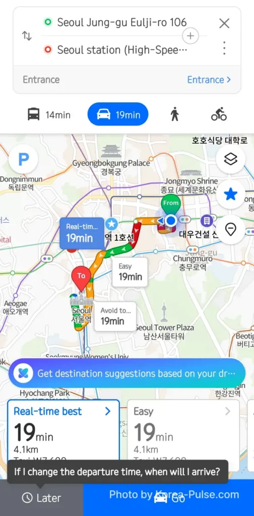
| Transit | 19 min (bus route) | 14 min · ₩1,550 (subway) | 23 min · ₩1,500 (bus) |
| Driving | Not available | 19 min · 4.1 km | Supported (not timed this round) |
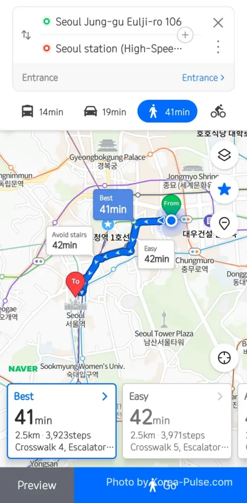
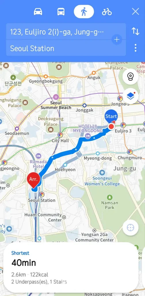
| Walking | Not available | 41 min · 2.5 km · 3,923 steps | 40 min · 2.6 km · 122 kcal |
One clarification before the deep dives: the app itself is not blocked here. Search, reviews, and transit all function on Google Maps. The gaps are car and foot navigation, and only those.
Google Maps: What Works, and the Wall You’ll Hit
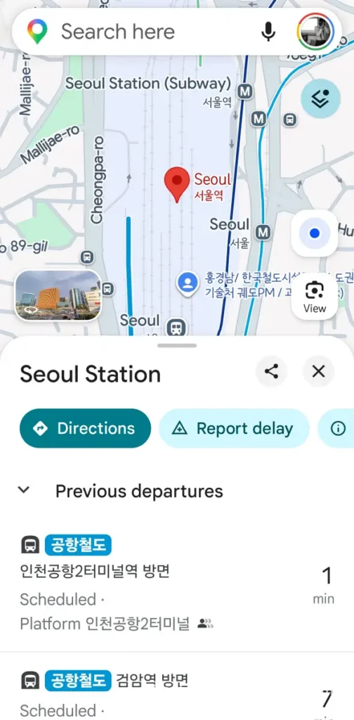
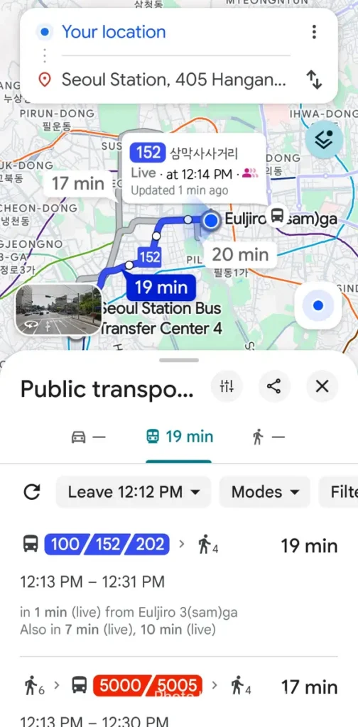
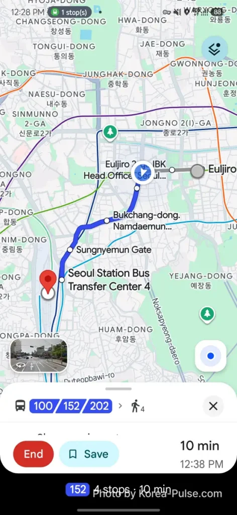
I searched Seoul Station, tapped Directions, and Google Maps handled public transit better than most travelers expect. It recommended a 19-minute bus route, showed live arrivals for buses 100, 152 and 202 down to the minute, and once I boarded, it tracked the ride and even reported the crowd level on my bus. For a service running on restricted map data, the transit layer is genuinely usable.
Then I tapped the Drive tab, and hit the wall this whole post exists for. “Can’t seem to find a way there.” The Walk tab shows the same blank dash. In Seoul, a city of nearly ten million people, arguably the world’s most-used map app cannot route you 4 kilometers by car or on foot. This is the export restriction made visible, and as of July 2026 it has not changed yet.
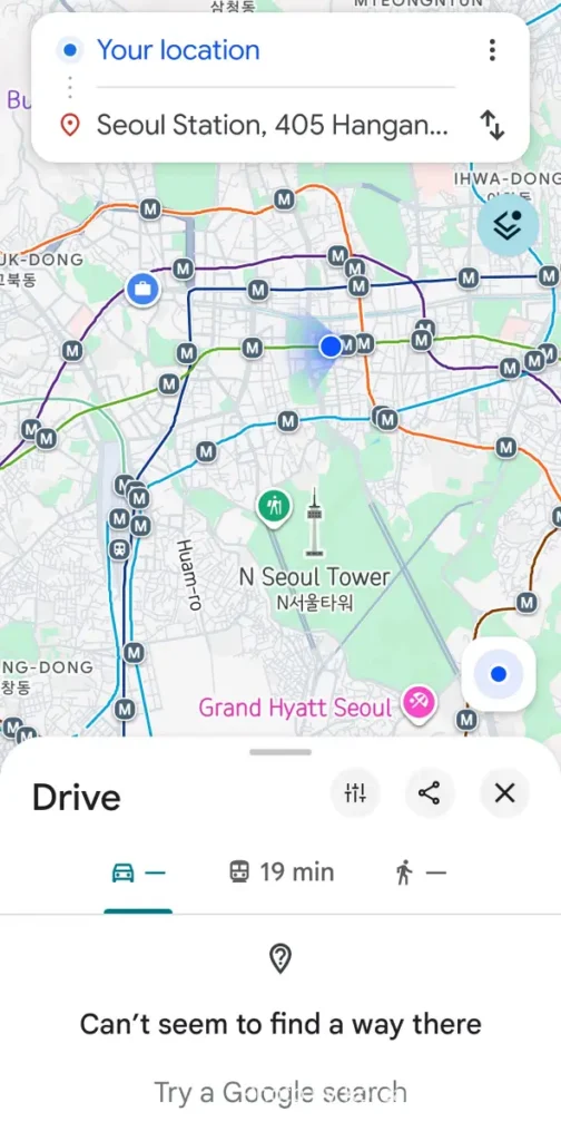
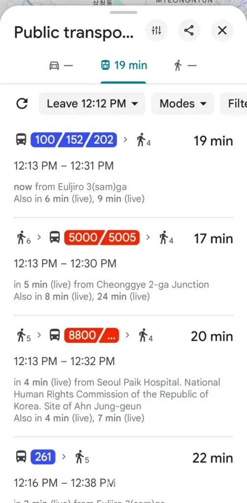
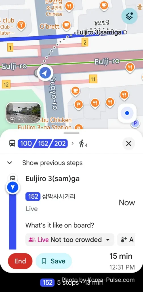
Two caveats from years of trying to make Google Maps work here. First, in my experience its position tracking in Seoul can drift, which is why I gave up using even the transit mode as my daily tool. Second, during the whole test ride it never once sent a notification or spoke up. It quietly assumed I was still on the bus. Fine for a map, not enough for a guide.
Do not delete Google Maps. Restaurant reviews, saved places, and your travel history all still work here, and its place information is solid. You just cannot ask it to take you anywhere by car or on foot. Yet.
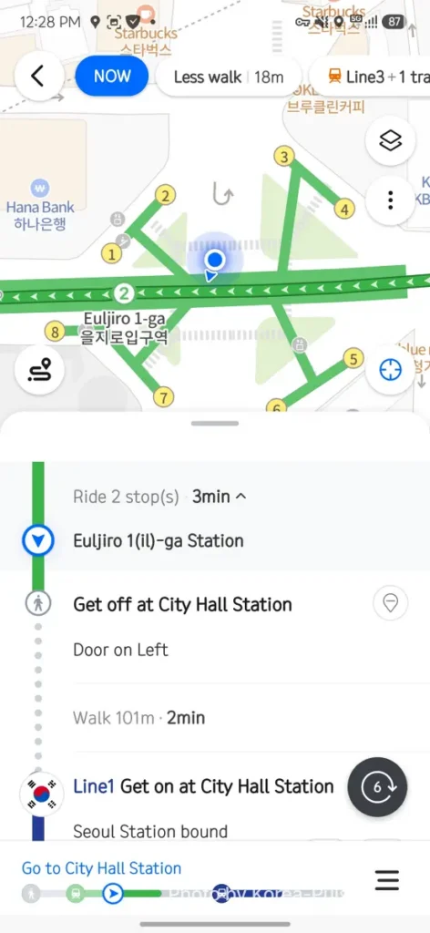
Same start point, same destination, and Naver’s app immediately found what Google’s bus route missed: the subway. Line 2 to City Hall, transfer to Line 1, done in 14 minutes for ₩1,550, with departure times, fares, and even which train car puts you closest to the transfer stairs (car 10-4, if you’re wondering). When a subway-plus-subway option exists in Seoul, take it. No traffic, no guesswork, and our family follows the same rule.
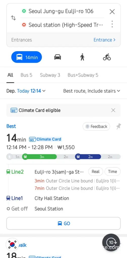
The other tabs tell you something about Seoul itself. Driving the same distance takes 19 minutes, longer than the train, before you even start thinking about parking. Walking takes 41 minutes over 2.5 kilometers, and Naver counts it as 3,923 steps, which pleased the dad in me who chases 10,000 steps a day. There is even an “avoid stairs” walking option, a quiet blessing if you are hauling a suitcase or pushing a stroller.
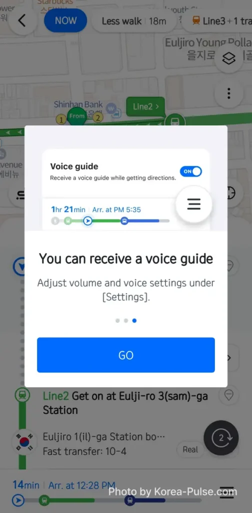
Now the feature that made Naver Map my keeper, and the one I most want travelers to know about: the alighting alert (승하차 알림). Pick a route, tap Go, and turn on the voice guide when the app offers it. Then put your phone away.
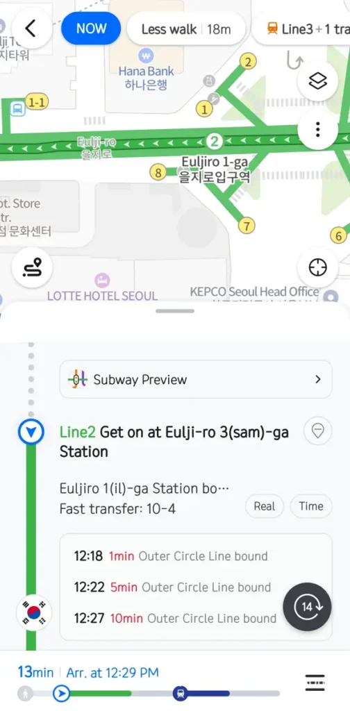
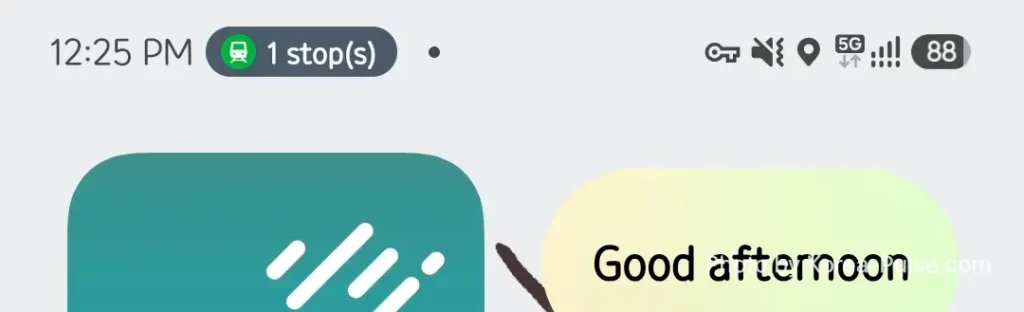
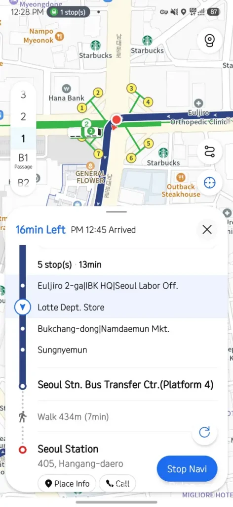
On the train, one station before my stop, my phone lit up: “1 station(s) left before you get off. Get off at City Hall Station.” My earphones announced it over my music, my watch buzzed, and a tiny “1 stop(s)” chip sat in the status bar while I read something else entirely. If you have ever sailed past your station on a packed rush-hour train where you cannot even see the signboards, you understand why this single feature is worth the install. It works the same way on buses.

Worried about a Korean app in English? The interface you saw in every screenshot above is the English one, straight out of the box. And reviews are covered too. Look up Myeongdong Kyoja, the noodle institution from my Myeongdong food walk: thousands of Korean reviews, and one tap on “View translation” turns any of them into English.


KakaoMap: A Solid Second Opinion
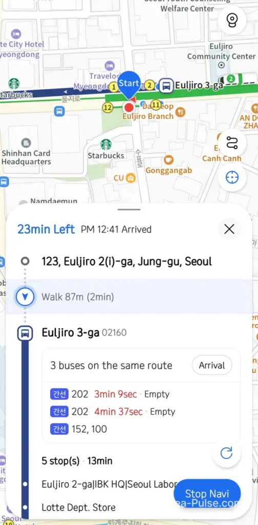
KakaoMap, the third app on the shortlist, is genuinely good. Same fresh-install test, same destination. Fares, live bus arrivals down to the second, even how empty each bus is. But its best transit suggestion was a 23-minute bus route with more walking, and for reasons I still don’t understand, the subway option that Naver surfaced first was buried. Maybe I caught an unlucky departure window. Either way, on this route it lost by nine minutes.
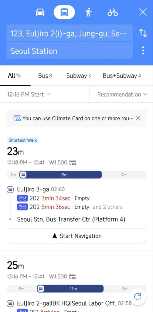
To be fair, its strengths are real: arrival countdowns to the second, a live “empty or crowded” reading for each bus, and fifteen route options where Naver handed me a shortlist. I rode its recommended bus route anyway. Navigation was clear, my position tracked correctly, and its remaining-time estimates ran the most conservative of the three, which is arguably the honest way to handle downtown Seoul traffic. Buses here are quicker than they look thanks to dedicated bus lanes, but not every street has one, which is exactly why my first advice in this city stays the same: when the subway is an option, take the subway.
Halfway Check: Which App Keeps Up When You Move?
Here is a problem with testing three apps at once: they wanted me on three different routes. Google put me on a bus, Naver on the subway, Kakao on another bus. I obviously could not ride all three, so I did the one thing that let me watch all of them at the same time. I walked. From Euljiro 3-ga to Euljiro 1-ga, roughly eight minutes on foot, with all three apps running to see which one correctly understood where I actually was and how it recalculated the time still left.
That underground stretch, by the way, is where I regularly watch travelers spin in circles holding their phones. Some are fighting Google Maps. A surprising number are fighting a map app from their home country that has clearly never heard of Euljiro. I have walked a few of them to the right exit myself. Consider this post me doing that at scale.

When I surfaced at Euljiro 1-ga and checked all three, each had tracked my movement correctly. Google showed my dot advancing along its bus route with the time remaining. Naver knew I was between stations on Line 2 with the City Hall transfer still ahead. KakaoMap held the most cautious clock of the three. None of them lost me underground, which honestly impressed me more than anything else that afternoon. The takeaway is not about who was fastest here, but that all three keep a reliable fix on you in a dense downtown, so the real deciding factor comes back to features like Naver’s alighting alert.
One footnote for drivers: Korea has a fourth heavyweight, T-map, and for pure car navigation it competes hard with Naver. But it is a driving app, not a general map, so for a visitor it stays off this shortlist. If you plan to rent a car and want the full comparison, tell me in the comments and I will make that its own post.
FAQ: Google Maps in Korea
Q. Does Google Maps work at all in Korea?
Partially. Place search, reviews, saved lists, and public transit directions all work, and transit even shows live bus arrivals. As of July 2026, driving and walking navigation do not work, so you cannot use it as a turn-by-turn guide.
Q. Is Naver Map available in English?
Yes. Every screenshot in this post shows the English interface on a fresh install, including voice guidance and alighting alerts. Korean reviews translate to English with one tap on “View translation.”
Q. When will Google Maps navigation launch in Korea?
No official launch date has been announced. The export was approved in February 2026, but data leaves the country only after the government verifies every security condition, and some observers expect at least six months of processing. I will update this post the day it changes (verify on the day you travel).
Q. Do I need KakaoMap too?
Not on day one. Naver Map covers everything a visitor needs. Install KakaoMap if you want a second opinion on routes, or if you end up using other Kakao services like Kakao T for taxis.
Q. How much data do these apps use? Can I go offline?
Normal use over mobile data is light and any tourist SIM handles it easily. Naver Map can optionally download offline driving maps (that is why my copy weighs 2.68GB against a roughly 363MB fresh install), but as a visitor on transit you will not need that.
Your arrival-day toolkit in two posts: sort your data with the SIM and eSIM price breakdown, install Naver Map from this one, and learn the turnstiles with the step-by-step subway ticket guide. Twenty minutes of prep, zero wandering in arcades.
Install Naver Map before you land. Keep Google Maps for reviews. Wait with me for Google to catch up.
A 19-year door has been unlocked, but it has not swung open yet. Until Google Maps in Korea gets its turn-by-turn moment, the best map app for Korea is Naver Map, and its alighting alert alone is worth the download. This Level 6 Local Guide will keep refreshing the news so you don’t have to.